 LoreRoad
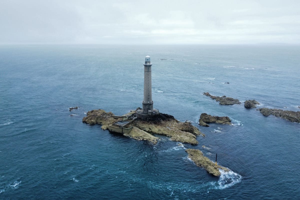 Photo by Stan Versluis · CC Pexels License undefined
Which Route 1 coastal landmarks can you enjoy without a lengthy stop?
Seven Route 1 coastal landmarks you can see from the car or a quick pullout, with towns, parking cues, and one‑line lore to read aloud.
You want great views without burning the whole afternoon
You’re cruising US Route 1, kids in the back, coffee up front, and a clock that won’t stop. You want coastal hits you can see from the road or from a fast pull-in, not a half-day detour. Here’s a driver-tested list of seven stops where you can grab the view, snap a photo, and roll on.
Tip on miles: US‑1 mileposts aren’t continuous across states, and local spurs vary. Use the town name and signed parking areas below; they’re the quickest way to nail the stop without hunting.
York: Nubble Light from Sohier Park is a classic, and it’s a quick turn
- Where: Cape Neddick, York, Maine (signed for Sohier Park)
- How to do it fast: From US‑1, swing briefly onto Route 1A/Shore roads to Sohier Park. This is a short, well-signed turn, not a long detour. The park is the standard viewing point for Cape Neddick “Nubble” Light, perched on its own rocky islet just offshore. See directions and public access described in the Maine Coastal Public Access guide by Maine DMR.
- Quick photo spot: The railing area right by the lot faces the lighthouse head-on. If the near bayside spots are full, do a slow loop; turnover is steady.
- One‑line lore to read aloud: “York’s Nubble Light is the postcard Maine keeps sending itself—only this one’s got gulls that heckle the tourists.”
Ogunquit: Marginal Way’s clifftop pull-ins scratch the ocean-view itch
- Where: Ogunquit, Maine (signed municipal lots off US‑1)
- How to do it fast: Park in a town lot near the shore and step onto the Marginal Way cliff path for an instant Atlantic panorama. Access points and parking options are listed on state and regional pages linked from Visit Maine. You don’t have to walk the whole path—one or two overlooks near the entrances deliver the goods.
- Quick photo spot: Any bench-facing cove near the main access—watch for spray on windy days.
- One‑line lore to read aloud: “Artists called this coastline ‘marginal’ only because the continent obviously ran out of patience here.”
Cape Elizabeth: Portland Head Light is inside Fort Williams Park—easy photo, big payoff
- Where: Cape Elizabeth, Maine (Fort Williams Park)
- How to do it fast: From US‑1, turn onto Route 77/Shore Road to Fort Williams Park. Follow the park signs to the Portland Head Light parking area. The official site’s directions page confirms the straightforward turnoff and where to park: Portland Head Light.
- Quick photo spot: The fence line just right of the lighthouse museum building frames the tower with surf and cliff.
- One‑line lore to read aloud: “George Washington okayed this lighthouse site—proof that even presidents appreciate a dramatic selfie angle.”
Rockland: Harbor pullouts face the Breakwater and its lighthouse
- Where: Downtown Rockland, Maine (harborfront near the breakwater)
- How to do it fast: US‑1 runs right through downtown; the harbor is immediately off the route. Pull into city lots near the waterfront parks. Reed Park and adjacent harbor areas give you a straight shot of the granite breakwater and, if the air is clear, the lighthouse at the far end. See parks and access described on the city’s page: Rockland Parks.
- Quick photo spot: Any spot along the upper harbor walk; telephoto helps bring the lighthouse in tight.
- One‑line lore to read aloud: “Rockland built a granite finger into the bay so ships could flirt with safety—and photographers could test their zoom.”
Camden: The harbor view is basically your co-pilot through town
- Where: Camden, Maine (US‑1 skirts the harbor)
- How to do it fast: As US‑1 dips into Camden village, the masts and moorings are right off your passenger window. For a short stop, pull into a signed downtown lot and stroll one block to the water. Regional planning and itinerary guides highlight Camden Harbor as an easy add-on from Route 1: PlanTrip Camden entry.
- Quick photo spot: Harbor Park’s edge near the footbridge; you’ll catch schooners framed by church steeples.
- One‑line lore to read aloud: “Camden is where postcards go to retire—quiet, photogenic, and always ready for one last sail.”
Wiscasset: Federal-era facades and a tidal river view—no detour needed
- Where: Wiscasset, Maine (historic downtown right on US‑1)
- How to do it fast: You’re already there—US‑1 is the main street. Pull into short-term parking along the historic storefronts and catch the Sheepscot River from the small waterfront nooks. Midcoast travel guides flag Wiscasset’s on‑route historic district as a natural quick stop: New England Travel Planner.
- Quick photo spot: The small overlooks at the south end of downtown facing the bridge.
- One‑line lore to read aloud: “Wiscasset once called itself the ‘prettiest village in Maine’—and frankly, the mirror agrees.”
Lubec: West Quoddy Head Light’s candy‑stripe tower is a signed spur away
- Where: Lubec, Maine (Quoddy Head State Park)
- How to do it fast: From US‑1, head toward Lubec on ME‑189; Quoddy Head Road is a short, paved access to the park and the famed red‑and‑white striped light. Regional guides catalog the destination and access as a straightforward side trip: UMaine Undiscovered Maine.
- Quick photo spot: The bluff just left of the visitor center door gives you the tower plus wave action.
- One‑line lore to read aloud: “This is the eastern edge of your continental bedtime—sunrise clocks in here before your coffee does.”
Where should you pull over so the driver stays sane?
- Favor named parks and municipal lots. Shoulders can be soft, sloped, or ticket-happy. Sohier Park (York), Fort Williams Park (Cape Elizabeth), and Rockland’s harbor lots are designed for quick in‑and‑out.
- Watch summer congestion. Popular overlooks turn over fast in the morning and late afternoon. Midday adds lines; plan quick hits early or after the beach crowd bails.
- Snap, then slide. If the front row is full, take the second row, hop out, shoot, and go. Your odometer will thank you.
Want the one-liners read to you automatically as you pass?
Every road has a story. LoreRoad tells it. Our app surfaces location‑aware facts and reads them out loud so the driver keeps eyes on the asphalt. See how the Facts trigger right as you roll past a viewpoint—no fiddling, no missed exits.
If you like planning two steps ahead, use the Map to preview what’s coming up on your route and mark quick‑stop candidates before you leave the driveway.
A rapid-fire plan you can actually run
- South to north, hit York (Nubble at Sohier Park), Ogunquit (Marginal Way overlook), Cape Elizabeth (Portland Head Light at Fort Williams), Rockland (harbor breakwater views), Camden (Harbor Park), Wiscasset (historic waterfront), then Lubec (West Quoddy Head Light).
- Keep your stop clock honest: if you can see the water and the landmark in one glance, you’re on track. If you’re lacing hiking boots, you’ve overshot the brief.
- If a lot is jammed, skip to the next town and cheer yourself with an extra lighthouse later.
Start the car, add these towns to your route, and set your first stop for Sohier Park in York.
Common questions
Can I see Nubble Light without leaving US‑1?
Not directly. Take the short signed turn to Sohier Park via Route 1A/Shore roads. The park is the standard viewpoint for Cape Neddick Light and is a quick pull‑in.
Is Portland Head Light a long detour from US‑1?
No. Fort Williams Park is reached via Route 77/Shore Road. The lighthouse viewpoint is near the parking area, so it’s a fast photo stop.
Which stops are best if traffic is heavy?
Rockland’s harbor lots and Wiscasset’s on‑route downtown are easiest because they sit right off US‑1. Camden’s Harbor Park is also close to the route with quick turnover.
Where are the safest places to park for Marginal Way?
Use Ogunquit’s municipal lots signed off US‑1. From there you can step onto the Marginal Way entrances for clifftop overlooks without hunting for curb space.
LoreRoad tells you the history behind every mile — surfaced as you reach it and read aloud, so the driver never looks down.
Get the appSources (7)
- Maine Coastal Public Access Guide (South Berwick to York)
- Portland Head Light / Fort Williams Park (official)
- Visit Maine — Walking & Hiking (Marginal Way entry)
- Rockland Parks & Recreation — Rockland Breakwater
- Plantrip — Midcoast Maine itinerary (Camden & Rockland references)
- New England Travel Planner — Midcoast Maine guide (Wiscasset/Bath/Bath historic references)
- University of Maine / Undiscovered Maine (Quoddy Head State Park listing)