 LoreRoad
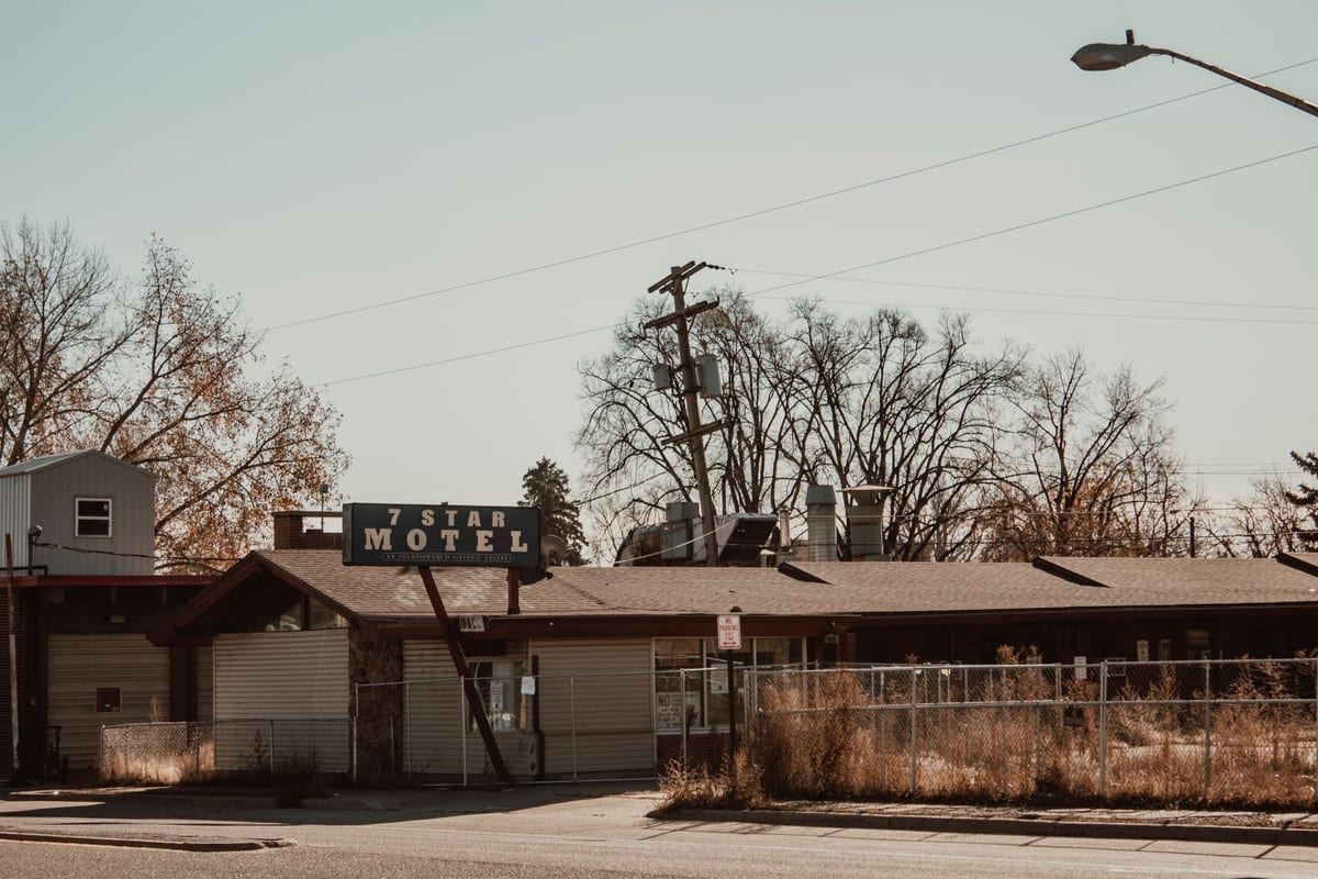 Photo by Hanawasthere · CC Pexels License undefined
Abandoned places you can see from the highway (safe stops)
A driver-safe, no‑trespass field guide to eerie roadside relics—what to look for, where to park, and how to shoot them legally from the road.
You want the spooky shot without the ticket or tow
You’re cruising past a hulking mill, a sunburnt motel sign, or a silent water tower and wonder: can I pull over, grab a photo, and keep rolling—legally? Yes, with a plan. Here’s a field guide to abandoned sights you can view from the road, how to tell if you can stop, and where the safe vantage points usually hide.
What counts as “see it from the road” (and what doesn’t)
If your feet stay on public pavement or in a signed pullout, you’re in the sweet spot. The moment you cross a fence, hop a rail, or slip a gate, you’ve left “roadside viewing” and entered trespassing territory. The practical line:
- OK: public sidewalks, public bridges with pedestrian walkways, signed scenic pullouts, rest areas, public parking lots, and legal street parking.
- Not OK: shoulder stopping where prohibited, railroad tracks, fenced rights‑of‑way, construction zones, and any land with “No Trespassing” or “Private Property” signs—even if a building looks abandoned.
Abandoned mills and factories: smokestacks and river bends are your compass
- What to spot: red‑brick blocks with tall smokestacks, sawtooth roofs, broken multi‑pane windows. Mills cluster near water; factories shadow rail lines.
- Where to view: highway river overlooks, public riverwalks, and city bridges with sidewalks. If the road parallels the river, expect a signed wayside or fishing pullout within a few miles. Those often give a straight shot across to the mill without stepping off public land.
- Photo tip: mills are big; shoot from across the water to show scale. Bring a short telephoto if you have one; it compresses the complex into layers.
Ghost service stations and roadside garages: corner‑lot gold
- What to spot: two pump islands under a flat canopy, glazed service bays, porcelain‑enameled signs that outlived the gasoline.
- Where to view: old alignments that run through small towns, not bypasses. Legal vantage points include the public sidewalk, city street parking, and sometimes a public lot across the intersection. Look for parallel parking stripes—if they’re painted and unbagged, they’re fair game unless posted otherwise.
- Photo tip: go three‑quarters angle from the corner crosswalk so the bays and the canopy line up in one frame.
Forgotten motels and neon: the roadside marquee without the “Vacancy”
- What to spot: long one‑story wings, exterior doors, and a freestanding neon sign with faded tubing.
- Where to view: frontage roads and business routes that shadow the main highway. Park in legal street parking or an active business lot with permission. If there’s no sidewalk, do not walk the shoulder—stay with your car in a signed spot and shoot from there.
- Photo tip: neon skeletons look best at blue hour. Set your phone to night mode, brace on the car roof, and keep it short so you’re not lingering in a marginal area.
Grain elevators and silos: follow the tracks
- What to spot: tall concrete or corrugated cylinders, headhouse on top, and spindly conveyors. These almost always sit where the road and a rail line run together into a town.
- Where to view: public streets at the edge of the elevator complex. Many towns have a designated “truck route” turnoff with a wide shoulder or a pull‑through lot—those are good viewing perches without entering private yards.
- Photo tip: align the roadway stripe into the frame to lead the eye to the elevator—instant composition.
Drive‑ins, diners, and defunct attractions: parking lots are your friend
- What to spot: drive‑in speaker poles, screen backs, A‑frame diners, and giant roadside mascots whose smiles have seen better days.
- Where to view: public frontage roads, park‑and‑ride lots, municipal parks abutting the property, or a business next door (ask if you’re unsure). Never enter the drive‑in field; those posts and grounds are private and often unsafe.
- Photo tip: for a drive‑in, the back of the screen from the public road is usually the cleanest angle.
Bridges, trestles, and industrial relics: the long view from public spans
- What to spot: rust‑red trusses and rivets, disused lift towers, and old rail trestles beside the modern bridge.
- Where to view: pedestrian sidewalks on highway bridges, public boat ramps under bridges, or riverside parks. All three keep you safely within public boundaries while giving an unobstructed angle.
- Photo tip: shoot from the upstream side to avoid sun glare in the afternoon.
Is it legal to pull over here? A quick, usable checklist
Use the signs in front of you; they outrank guesses.
- Look for a posted pullout, scenic overlook, or wayside symbol. If it’s signed for parking, you’re set.
- On high‑speed routes, skip the shoulder unless there’s explicit signage allowing parking or stopping. Shoulders are for emergencies and breakdowns.
- In towns, use legal street parking (check curb paint and posted hours) or public lots. Don’t block driveways or fire hydrants.
- Never step onto tracks, inside fences, or past “No Trespassing” signs. “Abandoned” to your eyes is often “owned and insured” on paper.
- If a law officer or property representative asks you to move along, do it. The photo isn’t worth the citation—or the tow.
Can I photograph it?
From a public place, photographing what you can see with your eyes is generally allowed. A few practical boundaries keep you out of arguments:
- Don’t point lenses into active residences.
- Skip drones unless you know the local rules and you’re not over people, traffic, or private land.
- Tripods on sidewalks are fine if you’re not blocking pedestrians. On bridges, keep gear tight to the railing and don’t set up in bike lanes.
Where the safe vantage points usually hide (by road feature)
- Pullouts and overlooks: Watch for brown or blue signs well before the viewpoint. They’re engineered for decel and re‑merge.
- Business routes and old alignments: When a bypass exists, the older road through town often has street parking with close views of the original roadside architecture.
- Riverwalks and greenways: Many towns built public paths along water; mills and bridges sit right there in the open.
- Trailheads and boat ramps: Public facilities near industry and old crossings. Park legally, keep it quick, and stay on the paved areas.
- Public transit park‑and‑ride: If it’s signed for public parking, it’s a safe place to leave the car while you grab a shot of a nearby relic.
Field‑spotter’s patterns: how to find cool stuff fast
- Water = industry: If your route hugs a river, expect mills, powerhouses, and old warehouses. Look for a named overlook or picnic pullout opposite the complex.
- Rails = elevators and depots: When the highway shadows a rail corridor into a town, there’s usually a grain elevator or a defunct depot near the first cross street.
- Old town square = ghost signage: Faded painted ads (ghost signs) cling to brick walls facing the square. Park on the square, walk the public sidewalk loop, and you’ll spot them.
- Bypasses = motels and neon: The business route preserves the lodging row. Drive the old strip at legal speed; pull into public parking for photos.
Safety in practice (so you bring back the story, not a citation)
- Park nose‑out for a quick exit. Keep headlights or hazards on if visibility is low.
- Don’t climb or enter anything, even if a door gapes. Structures fail silently.
- Keep gear minimal: phone, compact camera, and a small light if you’re near dusk. Leave pry bars, ladders, and “urban explorer” cosplay at home; they scream trespass.
- Share your stop: one person spots traffic while the other shoots. Trade off. Everyone goes home happy.
Make the most of the miles between stops
Seeing something strange out the window and actually knowing what it is are different joys. LoreRoad can do the talking while you drive: the app surfaces location‑aware stories about history, roadside oddities, food, and local legends and reads them aloud as you pass. That way the driver keeps eyes on the road while the car learns cool, spooky context. Peek at how those Facts trigger as you roll, or use the Map to see what’s coming up along your route.
If you’re wrangling a carful of co‑pilots while you pause at a pullout, hand them games instead of the steering critique. LoreRoad’s party‑friendly Games include License Plate Hunt, Road‑Sign Bingo, and The Impostor—easy to start, hard to put down.
A no‑trespass checklist you can screenshot
- Only stop where it’s signed for parking or you’re on legal street parking.
- Photograph from public sidewalks, public bridges, public parks, and public lots.
- Obey every fence and sign.
- Keep two wheels on pavement and your car fully inside the spot.
- Move along if asked by an official or property representative.
Quick itineraries you can build anywhere (without naming names)
- River mill loop: Pick a stretch where the highway kisses a river three times in 20–40 miles. Target the public bridge sidewalks and any waysides opposite big brick buildings.
- Elevator row: Follow a two‑lane that threads small towns 10–15 miles apart along a rail line. Plan stops at each town’s truck route turnout.
- Neon and motel relics: Drive the business route through two bypassed towns in a row. Aim for the hour before sunset and legal street parking across from each old sign.
What abandoned places can you safely view from the road?
- Brick mills and powerhouses across rivers from public overlooks or bridge sidewalks.
- Ghost service stations on town corners, viewed from public sidewalks or legal street parking.
- Neon motel signs and closed diners along business routes, from public lots or curb parking.
- Grain elevators next to rail lines, from public streets near the complex—no fences crossed.
- Old bridges and trestles, from public bridge sidewalks, riverside parks, or boat ramp lots.
- Drive‑in screens, from public frontage roads that face the back of the screen.
Your next move
Pick a 30–60 mile slice of your route on the Map, mark two public pullouts you can use for a view, and set a timer for a five‑minute stop at each. Keep it legal, keep it quick, and enjoy the haunt in plain sight.
Common questions
Is it legal to pull over on the highway to photograph an abandoned place?
Use signed pullouts, scenic overlooks, rest areas, or legal street parking. Don’t stop on a high‑speed shoulder unless it’s signed for parking. Photograph only from public places—sidewalks, parks, bridge walkways, and public lots.
Can I take photos of private property if I’m standing on a public sidewalk?
Yes—shoot what’s visible from where the public is allowed. Don’t point lenses into active residences, and never cross fences or enter gates to “get closer.”
How do I find a safe vantage point fast?
Scan for brown or blue signs announcing overlooks, use business routes through towns for street parking, and target bridge sidewalks, riverwalks, parks, and boat ramps that face the site.
What gear should I bring for quick roadside shots?
Keep it light: phone or small camera, a short telephoto for mills and bridges, and a microfiber cloth. Skip drones unless you know local rules, and avoid tripods where they block pedestrians.
LoreRoad tells you the history behind every mile — surfaced as you reach it and read aloud, so the driver never looks down.
Get the app